1. Was Greece part of the Roman Empire?
2. Was Egypt part of the Roman Empire?
3. The Roman empire is surrounded by which very large sea?
 |
| The Roman Empire 117 C.E.
This site will show you how it started in the city-state of Rome and then how it developed and expanded to its height. Click here
|
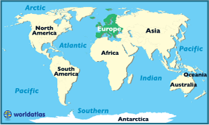
Here is a world map to show you Europe and Africa, where the Roman empire was located.
More pictures of Ancient Rome from around the world:
 |
| an amphitheatre built by the Romans in Spain in 2 C.E., that's over 2000 years ago. |
 |
| This is the remains of a very, very long wall that stretched across most of England. It is called Hadrians Wall and was used for protection (it was much taller before!) |
 |
| The theatre of Aspendus was built in 161-180 AD by the architect Xenon during the reign of Marcus Aurelius. It had an estimated capacity of 15'000 to 20'000 visitors. It is found in eastern Europe (Turkey). |
No comments:
Post a Comment